|
View Larger Map on Google (new window) | |
Explore the Leelanau County MapCheck below for recent additions to the map and help with navigating it!Leelanau.com receives over 100,000 visitors every month. If you'd like to get your link and ad on this page, click here for the details! The Leelanau.com Map is built using Google Maps, one of the most amazing pieces of internet software ever. We are in the process of adding information for towns, trails, businesses and much (much) more. We're adding short entries on the map that link to longer entries in our Leelanau Blog that will include photos and links to more information. They will display in the list the right, and if you have comments or questions or tips for people exploring that area, you can leave a comment!You can use the +/- signs to zoom in and out or double click to zoom in. If you have a scroll wheel, that also works. The buttons at the top right show a map view, the satellite view and the terrain view. While not perfect, every place we've checked the terrain was pretty close to right! The "sun" icons are for villages and you can expect that icons like hikers & bikers will show trails, cameras will show photos and we'll also be adding features like shipwrecks, beaches, boat launches and all kinds of other things.
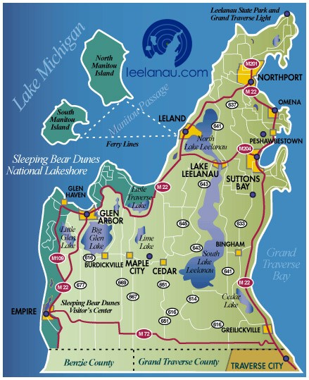
 For much more information in how to use the program, go to Google Map Support. Here are our old Leelanau County maps. |
10 most recent
Leelanau County Map News and Stories The Whaleback A Northport – Charleviox Passenger Ferry? Explore the Sleeping Bear Dunes The Leelanau Trail Bay View Trail Empire Bluff Trail Alligator Hill Trail Sleeping Bear Point Trail Pyramid Point Trail Good Harbor Beach |

